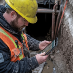
The Australian mining industry has never stood still. From the goldfields of Victoria to the iron ore plains of the Pilbara, the way we measure and map mine sites has changed dramatically. And right now, in 2026, one technology is leading that transformation more than any other: drones. For companies needing accurate mining surveys, drone technology is no longer a nice-to-have. It has become an absolute necessity.
Around 70% of large mining companies now use unmanned aerial systems, having initially adopted drones for surveying and mapping before expanding to broader applications.
So, why exactly are drones so important for mining surveys today? And how do they compare to traditional methods? Let’s break it all down-
What’s Changed in Mining Surveys?
Traditionally, mining surveys meant sending survey crews out on foot or in vehicles across vast and often hazardous terrain. Surveyors carried total stations, GPS receivers, and levels, manually recording data point by point. It worked, but it was slow, expensive, and at times, downright dangerous.
Fast forward to 2026, and the picture looks very different. Drones, also known as Unmanned Aerial Vehicles (UAVs), can now fly over an entire open-cut mine, capture thousands of data points per second, and produce a detailed 3D model of the site in a fraction of the time.
The Australian drone market, valued at AUD 619.90 million in 2024, is projected to grow at a CAGR of 24.70%, potentially reaching AUD 5.6 billion by 2034.
Drones vs Traditional Methods: A Clear Comparison
Let’s look at a straightforward comparison between drone-assisted surveys and conventional field surveys for mining operations.
| Factor | Drone Surveys | Traditional Surveys |
| Speed of data collection | Very fast; hours, not days | Slow; days to weeks |
| Safety for personnel | High; minimal exposure to hazardous zones | Moderate; field crew in danger zones |
| Stockpile volume measurement | Automated 3D volumetric models | Manual cross-sections, time-consuming |
| Topographic surveys | Dense point clouds, high-detail DTMs | Adequate but labour-intensive |
| Cost over time | Lower ongoing operational cost | Higher labour and equipment costs |
| Frequency of updates | Weekly or even daily feasible | Monthly at best, due to cost |
As this comparison shows, drone technology wins on nearly every practical front. That is why mining companies across Australia are now integrating drones into their survey operations, and why leading survey firms are investing heavily in UAV capabilities.
How Drones Improve Topographic Surveys at Mine Sites?
The drone surveying market in Australia is forecast to grow at a CAGR of 19.3% between 2025 and 2035, driven by extensive use in mining activities, environmental management, and infrastructure development.
Precision Mapping of Land Features
A topographic survey is designed to capture the “lay of the land,” including every gully, bench, slope, and rise. In a mining environment, this granular detail is vital because it serves as the foundation for guiding heavy earthmoving machinery, designing effective blasts, and planning safe, stable access roads for the fleet.
High-Density Data Generation (LiDAR & Photogrammetry)
Modern drones utilise advanced sensors, such as LiDAR and high-resolution photogrammetry, to create “point clouds”: massive collections of data points that map the surface in 3D. These are processed into Digital Terrain Models (DTMs) and Digital Elevation Models (DEMs), providing a digital twin of the site that is far more detailed than traditional 2D maps.
Unmatched Operational Speed
A drone can survey hundreds of hectares in a single day, a task that would typically take a traditional ground-based crew a full working week. This allows projects to move from the planning phase to execution much faster.
Temporal Change Tracking
Because drones are cost-effective and easy to deploy, they can be used for regular, repeat surveys. This allows mine managers to monitor how the topography changes over time.
Drones and Cadastral Surveys in Mining Regions
Cadastral surveys define legal land boundaries, which are critical for mining leases and compliance. Any errors risk costly disputes or shutdowns. Drones enhance these surveys by providing precise geospatial data that verifies boundary locations.
When paired with GNSS ground control, drone imagery ensures the high-level accuracy required to document and maintain complex mining tenements and exploration licenses.
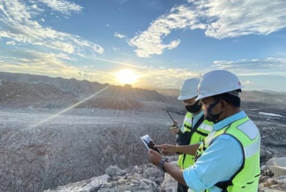
Value for Surveyors in Alice Springs and Remote Operations
For surveyors in Alice Springs, drones are a game-changer. The Northern Territory’s vast distances and extreme heat make traditional ground surveys costly and slow. By deploying UAVs, teams can capture complete datasets in a single day, slashing travel and accommodation expenses.
This efficiency enables more frequent updates, ensuring remote mining operations remain productive and safe while being guided by accurate, real-world data without the logistical burden.
Why Surveyors in Melbourne Are Also Embracing Drone Technology?
Drones are transforming surveyors in Melbourne by providing efficient, non-disruptive data collection for quarries and mineral sites near populated regions. By deploying compact UAV systems, surveyors can capture comprehensive geospatial data without the need for extensive ground crews.
This significantly accelerates project turnarounds and improves client satisfaction. Embracing this technology ensures better outcomes for Victorian mining operations while keeping survey firms at the forefront of the industry.
Key Applications of Drones in Modern Mining Surveys
- Volumetric Stockpile Measurement: Precise calculation of ore and waste material volumes using 3D aerial models, reducing guesswork in production reporting.
- Pit and Bench Mapping: Regular drone flights provide up-to-date maps of excavation progress, helping teams track production against mine plans.
- Blast Pattern Design: Pre-blast topographic data captured by drones ensures blast engineers have accurate surface conditions for pattern design.
- Wall Stability Monitoring: Time-series drone surveys detect subtle ground movement, giving early warning of potential slope instability.
- Infrastructure Layout: Drones assist in setting out roads, conveyor routes, processing plant footprints, and other mine infrastructure.
- Regulatory Compliance Mapping: Accurate mining surveys from drone data support required reporting to government agencies and regulators.
- Environmental Monitoring: Drone imagery tracks vegetation, water management, and rehabilitation progress around mine footprints.
Safety First: A Major Reason to Choose Drone Surveys
Safety is the primary driver of drone adoption in Australian mining. By removing personnel from high-risk zones, such as active blast sites and unstable highwalls, drones ensure compliance with strict safety regulations.
UAVs capture precise data across hazardous terrain without exposing surveyors to ground movement or machinery risks. Ultimately, drone-assisted mining surveys provide a meaningfully safer environment, protecting lives while maintaining the high standards required by responsible operations.
What to Look for in a Drone Survey Provider?
Not all drone survey services are equal. When selecting a provider for mining surveys, it pays to ask the right questions.
- Does the team hold CASA (Civil Aviation Safety Authority) operator accreditation?
- Do they use survey-grade GNSS ground control points?
- Can they deliver outputs that integrate directly with your mine planning software?
Experience matters enormously in this field. Mining environments are complex, and surveyors need to understand not just how to fly a drone but also how to interpret and apply the data in a mining context. Choosing a provider with genuine mining survey credentials, not just general drone operators, ensures you get results you can actually rely on.
Choose 2Survey for Your Mining Survey Needs.
At 2Survey, we combine advanced drone technology with deep mining surveys expertise to deliver accurate, reliable spatial data across Australia. Our services cover underground mine surveying, topographic surveys, cadastral surveys, stockpile volumes, ground movement monitoring, and full survey control networks; all underpinned by GNSS systems, robotic total stations, and professional-grade UAV platforms.
We work directly with engineers, project managers, and site supervisors to make sure every data point counts. Remember- 2Survey has the accurate tech and the talent to deliver!
FAQs
What are the primary benefits of using drones in mining?
Drones provide rapid data collection, significantly reducing survey times from weeks to hours. They enhance safety by keeping personnel away from hazardous zones while delivering high-resolution 3D models and precise volumetric measurements.
How accurate are drone surveys compared to traditional methods?
Modern drones equipped with RTK and PPK technology achieve centimetre-level accuracy. When combined with ground control points, they provide reliable data for high-fidelity applications like infrastructure planning and legal boundary verification.
What is the difference between photogrammetry and LiDAR in drone surveys?
Photogrammetry uses high-resolution images to create 3D models, while LiDAR uses laser pulses. LiDAR is particularly essential for penetrating dense vegetation or capturing accurate ground data in low-light conditions and complex terrain.
Are drone surveys legally compliant for Australian mining leases?
When operated by CASA-accredited professionals using survey-grade GNSS, drone data meets strict regulatory standards. This data is critical for reporting to government agencies and managing complex cadastral boundaries and exploration licenses.
Can drone data integrate with existing mine planning software?
Professional drone survey outputs are provided in standard formats, such as DTMs and point clouds. These integrate seamlessly with CAD and GIS software, allowing engineers to use the data immediately for planning and analysis.