Did you know that 38% of global construction disputes are triggered by nothing more than defective design plans and inaccurate site data? In the high-stakes world of property development, a single misplaced fence line can turn a profitable project into a decade-long legal nightmare.
The difference between a seamless build and a courtroom battle usually comes down to one question: was your land measured for what it looks like, or for where it legally begins? When weighing a cadastral survey & topographic survey, the distinction is critical.
While a topographic survey captures the physical “relief” and features of the terrain, a cadastral survey is the essential legal process for defining and protecting your property boundaries.
What is a Cadastral Survey?
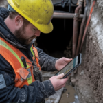
A cadastral survey is essentially the legal “DNA” of a property. It is the primary tool for establishing property boundaries, subdivision lines, and easements. In Australia, this is a highly regulated field where only licensed professionals can perform the work. They spend significant time researching historical titles and government records to ensure that the physical pegs placed in the ground match the legal documents held by the state. Whether you are looking for surveyors in Alice Springs for a vast pastoral boundary or in Melbourne for an inner-city subdivision, the cadastral survey is the final word on what you actually own.
What is a Topographic Survey?
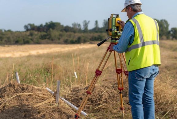
If the cadastral work defines the legal limits, the topographic survey maps the physical reality. This survey captures the “relief” of the land, showing elevation changes, natural features such as trees and creeks, and manufactured structures, such as buildings and utility poles. For engineering surveyors, this data is the foundation of any design. It allows them to understand how water will flow across a site or where a building’s foundation needs to sit to remain stable. To get the full picture of a site’s potential and its restrictions, a combined cadastral survey & topographic survey is often the gold standard.
Core Differences
The fundamental divide between a cadastral survey & topographic survey lies in their intent. One is a legal instrument (cadastral), while the other is a design and planning tool (topographic). While a topographic survey might show where a fence is, only a cadastral survey can tell you where the fence should be.
In Australia, roughly $14.2 billion is spent annually on construction rework, with inaccurate data accounting for 14% of those errors. Understanding the interplay prevents costly design errors.
Legal Standing vs. Physical Mapping
A cadastral survey is legally binding. It involves creating plans that are lodged with government land registries. Conversely, a topographic survey is a functional map. Architects and engineers use it to visualise the site’s 3D characteristics, but it carries no legal weight for ownership purposes.
Elevation and Contours
In a topographic survey, vertical data (height) is just as important as horizontal data. You will see contour lines showing the steepness of a hill. In a standard cadastral survey, the focus is almost entirely horizontal, defining the land parcel’s perimeter.
Surface Features vs. Boundary Markers
A topographic survey includes everything visible: trees, maintenance holes, and sheds. A cadastral survey focuses on “monuments”: physical markers such as iron pins, concrete nails, or wooden pegs that mark the property’s mathematical corners.
When Do You Need Each Survey?
Choosing the right service depends on your project stage. You need a cadastral survey if you are buying or selling land, splitting a lot into two, or building a permanent structure near a boundary. It provides the legal certainty required for property transactions.
You need a topographic survey during the planning and design phase. If you want to build a house that maximises a view or requires complex drainage, your architect cannot work without a topographic map.
At a Glance
| Feature | Cadastral Survey | Topographic Survey |
| Primary Goal | Define Legal Ownership | Map Physical Terrain |
| Critical For | Fences, Subdivisions, Titles | Architecture, Drainage, Foundations |
| Output | Boundary Pegs & Title Plans | Contour Lines & 3D Models |
In more specialised cases, such as resource extraction, mining surveying is required to map underground depths and volumes, often combining elements of both surface mapping and legal lease boundaries. For large-scale developments, conducting a cadastral and topographic survey simultaneously is the most efficient approach.
How They Work Together in a Project Lifecycle
In a successful project, these surveys are not used in isolation; they flow into one another. For surveyors in Melbourne working on a new high-rise, the process starts with a cadastral survey & topographic survey to define the site and its challenges.
Once the design is finished, engineering surveyors take over. They use the data from both previous surveys to “set out” the building. They ensure the skyscraper is built within the legal boundaries (cadastral) while also ensuring the floors are perfectly level according to the site’s elevation (topographic). If the project involves deep excavation near tunnels, a mining surveying expert may be brought in to monitor ground movement. In these complex environments, the data from a cadastral survey & topographic survey remains the baseline for all safety monitoring.
How Modern Technology Is Changing Both Survey Types
The “Terrain Delta”, the gap between old paper records and modern reality, is closing fast. Professionals providing land surveys in Darwin or Alice Springs now use high-precision GPS and drones to cover vast distances that previously took weeks. This technology enables a topographic survey to be completed in hours, with millions of data points.
However, technology has not replaced the “detective work” of a cadastral survey. While we use lasers and satellites, the professional still has to interpret 100-year-old survey markers. The real innovation in 2026 is the “Digital Twin,” where engineering surveyors create a live 3D model that combines legal boundaries, physical topography, and even underground mining surveying data into one seamless interface.
By merging cadastral and topographic data into a BIM (Building Information Modelling) environment, we reduce construction ‘clash’ errors by up to 50%.
Choosing the Right Surveying Partner
Only 31% of construction projects currently come within 10% of their original budget, primarily due to unforeseen site conditions identified too late in the process.
Whether you are navigating a complex cadastral survey in a bustling suburb or requiring a high-precision industrial survey for a massive infrastructure project, the right data is your most valuable asset. The synergy found in a cadastral survey & topographic survey ensures no detail is overlooked.
2Survey is established to deliver that exact certainty. Driven by directors with over 25 years of combined experience, we provide a performance-driven mindset to every engineering, commercial, and residential challenge. From the outback expertise required for land surveys in Darwin to urban precision, we offer the full suite of specialised services, including mining surveying and expert industrial survey solutions.
Build with confidence and turn complex land data into your competitive advantage at 2survey.com.au!
FAQs
Can a topographic survey be used to settle a boundary dispute?
No. While a topographic survey shows the location of existing fences, it carries no legal weight regarding ownership. Only a licensed cadastral surveyor can legally redefine or confirm property boundaries and settle disputes in court.
Do Melbourne surveyors charge more for cadastral work than topographic mapping?
Generally, yes. Melbourne surveyors performing cadastral work take on significant legal liability and must be licensed by the state. This specialised “detective work” through historical titles often makes it more labour-intensive than a standard topographic design map.
Is a “boundary survey” the same as a cadastral survey?
In many contexts, yes. In Australia, a cadastral survey is the formal term for a survey that defines land boundaries for title registration. A “boundary survey” is the term homeowners use to find the pegs of their property.
How long does a cadastral survey & topographic survey take to complete?
Fieldwork for a standard residential lot usually takes 1–2 days. However, the cadastral component requires extensive office research into government records. Expect a turnaround of 2–3 weeks for the final certified plans to be lodged and processed.
Can I build a fence based only on a topographic map?
It is highly discouraged. A topographic map shows where a fence is, not where it should be. To ensure your new fence is legally compliant, Melbourne surveyors recommend a boundary re-establishment (cadastral) survey to avoid future “encroachment” legalities.