Ever wondered why big Australian infrastructure projects, including rail lines and roads, are completed on time and at a lower cost? It can be as simple as making clever decisions in surveying and engineering. Modern techniques like LiDAR and drone surveying significantly improve project efficiency, accuracy, and safety, leading to better outcomes and cost savings. Below, we will deconstruct engineering surveying and traditional surveying, highlighting why the current technology offered by leading Australian surveying firms, such as 2Survey, is revolutionizing road and rail surveying in Australia. Keep reading to find out which approach will work in the next project.
What do we mean by Engineering Surveying?
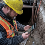
Engineering surveying surveys and maps land for construction with precision for large-scale projects such as bridges, roads, and buildings. It is unlike simple land checks; it processes complex data from rail infrastructure surveyors and road and rail surveying Australia projects. Tools such as DJI drones, Leica scanners, and 12D software are being used by companies such as 2Survey to process point clouds, aerial imagery, and BIM models.
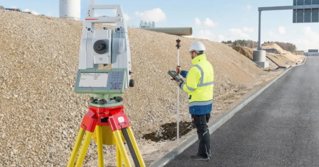
This technique is dazzling in the Australian survey firms that address the high-rise buildings or industries. It establishes control networks, levels, and prism positions that are to be accurate throughout life. Consider it the GPS brain in projects such as Melbourne Water or LXRP rail works.
The classical Surveying Techniques are described
Conventional techniques use the physical application of tools such as tape measures, theodolites, levels, and primitive GPS. The surveyors make site walks, measure points manually, and sketch. These methods laid the initial roads and rails in Australia, providing reliable accuracy for minor projects and early cadastral surveying work.
Advantages include a low startup cost and familiarity, so no training is required; it is easy. They are fast and inexpensive for a basic boundary check. Yet they require clear views, fine weather, and manpower, which are harder to come by on large sites and complex industrial surveying environments.
Key Differences: Engineering Surveying vs Traditional Methods
Modern engineering surveying leaps ahead with tech like total stations, LiDAR, and drones. Here’s a quick comparison table for clarity:
| Feature | Traditional Methods | Engineering Surveying |
| Speed | Slow, manual point-by-point |
Fast, covers large areas in hours |
| Accuracy | High for small spots, error-prone |
Millimeter precision over 100m+ |
Cost for Big Projects |
High labor, delays add up |
Lower long-term via efficiency |
| Safety | Risky in tough terrain |
Remote drones/scanners keep teams safe |
Data Output |
Basic sketches, manual notes |
3D models, point clouds, BIM-ready |
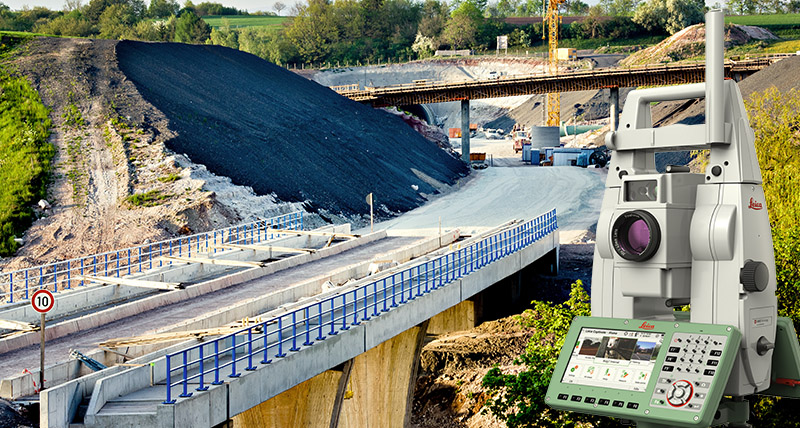
Australian Surveying Companies Win Representations in the Real World
Take 2Survey: They use 12d Synergy to prepare data on bridges and drainage using large-scale infrastructure data from Rail and Melbourne Water. The drones and MS60 scanners provide CAD and BIM files in a short time span – eliminating weeks of field work. Trust in our expertise ensures your project is handled efficiently and accurately. Across Victoria, surveyors Melbourne infrastructure teams depend on are leveraging this advanced technology to meet strict compliance standards while accelerating delivery timelines.
This reduces survey time by up to 80 per cent compared to conventional surveying and improves accuracy to ±2mm at long distances. The rail infrastructure surveyors who use these tools complete projects at a lower cost and in a safer manner, particularly in remote outback areas of Australia.
The in-between strategies are also practical: start with the old-fashioned approach to verify, then scale it with modern technology. Many Australian project managers and engineers are adopting this hybrid approach to ensure seamless integration with existing workflows, reducing disruption and maximizing accuracy. To achieve the best results, the top Australian surveying companies use the hybrid approach.
In Cases Where Traditional Methods are the Bottom Line
Not every job needs high-tech. Traditional tools are affordable and accurate for covering small residential boundaries or for a speedy stakeout, without the learning curve that would occur with a local team.
They are perfect for flat, reachable, cash-strapped places. However, they are too slow and too coarse for engineering surveying in booming infrastructure.
The Future: Why Engineering Surveying is the Clear Winner
Engineering surveying outperforms traditional methods in speed, safety, and data richness—perfect for Australia’s growing road and rail demands. Modern tools like those at 2Survey future-proof projects against errors and delays.
As rail infrastructure surveyors adopt LiDAR and drones, traditional methods are becoming the exception. The verdict? Engineering surveying wins for most modern needs.
Ready to level up your next project? Contact 2Survey for expert road and rail surveying in Australia. Get a free quote today and see the difference!
Frequently Asked Questions (FAQs)
Engineering surveying uses advanced technology like LiDAR, drones, and laser scanners to map land for large-scale construction projects with millimeter precision. Unlike traditional methods that rely on manual measurements and basic tools, engineering surveying delivers 3D models, point clouds, and BIM-ready data faster and more accurately for road and rail surveying Australia projects.
Rail infrastructure surveyors choose engineering surveying because it’s faster, safer, and more precise. Australian surveying firms like 2Survey use drones and MS60 scanners to capture complex railway data in hours instead of days, reducing survey time by 80% while maintaining ±2mm accuracy over long distances, critical for road and rail surveying Australia infrastructure.
Traditional methods work best for small residential boundaries, simple stakeouts, or budget-limited projects on flat, accessible sites. However, for large-scale engineering surveying projects like bridges, highways, or industrial facilities, modern technology from Australian surveying firms delivers superior results in speed, safety, and accuracy.
Engineering surveying reduces survey time by up to 80% compared to traditional methods. What takes days with manual measurements can be completed in hours using drones and laser scanners. 2Survey and other leading Australian surveying firms deliver rapid data processing for road and rail surveying Australia projects, keeping timelines on track.
Yes! Engineering surveying significantly improves safety by using remote drones and scanners that keep rail infrastructure surveyors away from hazardous terrain, traffic, and difficult conditions. Traditional methods require surveyors to physically access dangerous locations, while modern technology allows safe data collection from a distance on road and rail surveying Australia sites.
Leading Australian surveying firms like 2Survey use DJI drones, Leica MS60 scanners, total stations, LiDAR technology, and 12D Synergy software. These tools create accurate point clouds, 3D models, and BIM files for rail infrastructure surveyors working on complex road and rail surveying Australia projects, delivering millimeter precision and faster project completion.