If you own land and are looking to conduct a property transaction, you must know about cadastral surveying in QLD. This is no longer optional, but yeah, it is essential.
In 2026, property boundaries, development approvals, and infrastructure projects across Australia rely heavily on accurate cadastral data. From residential blocks in Brisbane to large-scale developments, engineering surveying services in Australia are very supportive.
Guess what!
Cadastral surveying in QLD has become the legal foundation behind every title and boundary line.
As a professional working closely with property developers and infrastructure teams, I now see some common issues. And these issues affect people who are often confused about cadastral surveys and basic boundary checks. They are not the same, and choosing the wrong service can delay projects and cost thousands.
So, to help you out, this guide is for you, which explains exactly what a cadastral survey is, how it differs from a boundary survey, and how much you should realistically budget in Australia in 2026.
What is a Cadastral Survey?
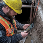
A cadastral survey in QLD is a legally recognized land survey used to define, mark, and record the boundaries of a parcel of land.
In practical terms, a cadastral survey helps to create or confirm property boundaries. This is done to measure lot sizes and dimensions, define land parcels for registration, and prepare accurate legal descriptions. Land titles offices then use these records to support ownership, subdivision, and development approvals.
Cadastral surveying in QLD follows strict requirements which are set by the Surveyors Board of Queensland and the state’s cadastral standards.
And the result of the cadastral survey becomes part of the public land register. This is why it is not simply a technical service; it is a legal process.
From subdivisions and new land titles to infrastructure corridors supported by industrial construction surveying services in Australia, cadastral surveys underpin almost every development process.
What Is a Boundary Survey?
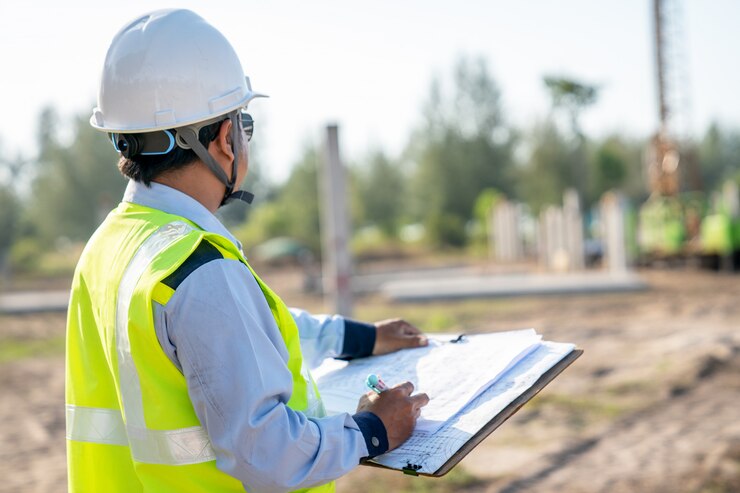
A boundary survey is all about clearly identifying the legal edges of a property. In everyday terms, it tells you exactly where your land starts and ends.
A question may arise in your mind about where your land really begins and ends.
In practice, a surveyor reviews official title documents and past survey plans, then conducts precise on-site measurements. This is the only reliable way to locate the true corner points and boundary lines of a property. This helps remove assumptions and replace them with boundaries that legally match government records. Moreover, a boundary survey looks at your existing fence, which actually follows the legal boundary – or if it sits a little inside your land, or even over the line.
The same applies to nearby structures. Sheds, retaining walls, driveways and small extensions can slowly drift across boundaries over time.
One more thing: when buying a property, buyers often request a boundary survey to ensure the land they are purchasing is exactly what appears on the title before settlement.
In areas such as Darwin and across regional parts of the Northern Territory, boundary checks are frequently combined with broader cadastral and boundary surveys in the Northern Territory . This helps verify older titles and historic boundary marks that are no longer clearly visible on the ground.
What Is the Difference Between a Boundary Survey and a Cadastral Survey?
While going for Land development, one might get confused about which service to choose between Boundary survey and cadastral surveying in QLD.
Don’t get confused!
A simple way to understand the difference:
| Aspect | Boundary Survey | Cadastral Survey |
| Primary Purpose | Checks and identifies existing boundary positions using current records. | Legally creates, redefines, or establishes boundaries for land registration. |
| Key Focus | Verifying boundaries. | Legally defining boundaries. |
| When Needed | General land development to confirm existing boundaries. | Subdividing land, creating new lots, and altering titles (e.g., required in QLD). |
| Relation to Projects | Supports checks before development. | Ensures land ownership and legal corridors before major infrastructure/construction. |
| Supporting Services | Often paired with engineering surveying for infrastructure in Australia. | Essential for legal land establishment prior to building. |
Major infrastructure projects are mainly supported by engineering surveying services providers like 2Survey in Australia. On the other hand, cadastral surveys ensure land ownership and legal corridors are correctly established before construction begins.
How to Hire 2Survey Cadastral Survey Company in Australia, 2026
At 2Survey, the focus is not simply on marking boundaries, but is always with you to support you.
And if you really want to hire 2Survey for cadastral work in Australia in 2026, we can explain step by step in practical points:
Check Legal Standing and What Services They Are Licensed to Provide:
In the search for a cadastral survey firm, you will begin by ensuring that the firm is registered as well as licensed to carry out cadastral and boundary surveys. Through 2Survey, licensed surveyors are permitted by law to undertake title re-establishment, boundary definition, subdivision surveys, and easement surveys throughout Victoria and the Northern Territory, all of which have legal implications for titles and approvals. Their team complies with the statutory requirements and handles the entire research and fieldwork process through to the certified lodgment of plans.
Get to Know Their Experience in Surveying:
It is prudent to look at an organization that does not merely do boundary work but also engineering and construction surveying, data management, industrial and commercial work and upscale services such as drone and laser scanning. This broad exposure will ensure that your cadastral project remains compatible with future changes and technical specifications.
Ensure Complete Support of the Project Immediately:
A trusted surveyor must take care of every step of cadastral surveying in QLD – initial title investigations and site work, drafting and compliance checks and formal registration with land administrations. 2Survey offers all these end-to-end solutions, so you do not even have to coordinate multiple consultants or seek approval and formal registration with land authorities yourself.
Find Local and National Capacity:
Cadastral surveying in QLD may differ by state and location. If you have multiple jurisdictions on a single piece of land, such as Queensland and the Northern Territory, having a survey firm operating in those areas will be of great benefit to you, as it will serve your purpose regardless of where your project is based. 2Survey operates across Melbourne, Brisbane, Darwin, and other areas, and experienced surveyors Melbourne property developers rely on ensure that projects meet both local council regulations and national cadastral standards. As such, it will work with you because these are the places where you are located.
This mixture enables developers, builders and landowners to integrate effortlessly between legal land definition and construction delivery. And our pragmatic approach reduces time wasted in approvals and helps clients avoid costly redesigns due to incorrect boundary information.
Conclusion
Cadastral surveying in QLD is no longer just a technical requirement; it is a legal requirement for property ownership and development in the year 2026.
Whether you’re dealing with new lot creation, boundary problems, or infrastructure delivery, cadastral surveying in QLD is the foundation for every successful project.
However, as compliance and integration standards increase, working with a company as experienced and knowledgeable as 2Survey will ensure your cadastral work is both correct and relevant from a modern engineering and construction perspective.
If you wish to ensure a smooth progression of your land project from title to construction, professionally prepared cadastral surveys will be a good first step.
Contact us Today!
FAQs
Q1. What is a cadastral survey?
Ans. A survey that provides information about boundaries and land parcels, to register such land with a land authority, is referred to as a cadastral survey. A survey that is undertaken does, in effect, create land titles.
Q2. How long does it take to complete a cadastral survey?
Ans: The estimation of Residential Cadastral Surveys is usually completed within a period of between two and six weeks.
Q3. How do I choose a cadastral surveyor in Australia?
Ans: It should be a licensed, experienced, and knowledgeable company in cadastral surveys in the QLD sector and engineering surveying services in Australia.
Q4. Why is my property needed to have a cadastral survey?
Ans: A cadastral surveying in QLD will be required for the creation of new titles, subdivision of land, and, most particularly, where there are unclear boundaries.
Q5. How much does a cadastral survey cost in Australia in 2026?
Ans: Cadastral survey costs in Australia in 2026 vary by property size, location, terrain, and surveyor expertise, often ranging widely based on complexity.