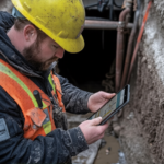
The Northern Territory (NT) is unlike any other place to conduct a survey. The immense distances, ruggedness, remote settlements, and brutal weather conditions would not be satisfied with normal surveying operations, but demand a combination of high technology, local experience and careful planning. At 2Survey, we actualise this marriage within the context of many services that are applicable to infrastructure, mining, roads, pipelines, and community development in NT and beyond.
Dive in to know more about remote project surveying in the Northern Territory.
Knowing the Terrain and the Environmental Difficulties
Remote Northern Territory landscapes are arid, savanna, rocky escarpment, floodplains, and regions lacking or having minimal access road infrastructure. The survey in this case must consider:
- Transport logistics, equipment, and personnel over long distances.
- Minimal shelter and severe weather (heat, seasonal flooding, dust) to instruments.
- Changeable topography that might obscure the line-of-sight of optical equipment or satellite transmissions.
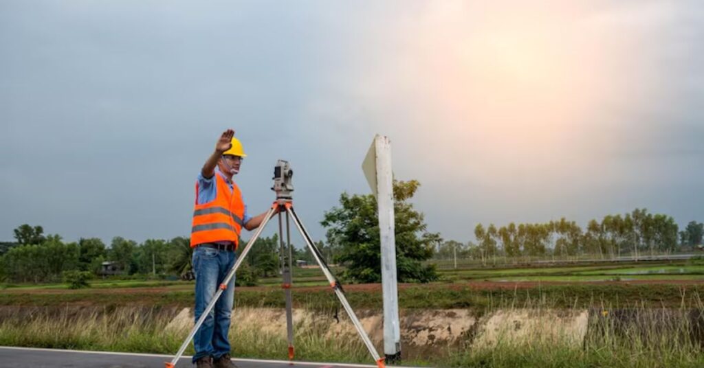
Leading surveyors in the Northern Territory will start each of the projects with a site reconnaissance, risk assessment, outreach to domestically engaged parties (including Indigenous landowners), and access, safety and environmental protection planning.

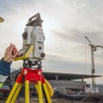
State-of-the-art Remote Precision Technologies
The use of modern remote surveying in the NT is based on various innovative technologies, which include:
- GNSS: Geospatial data (with differential or Real Time Kinematic corrections) is highly accurate even in remote locations with high-precision satellite positioning systems.
- LiDAR: LiDAR sensors or photogrammetry are very handy to explore large, inaccessible locations within a short duration, create digital terrain models, and produce high-resolution imagery.
- Robotic Total Stations and Radio Control Tools: This enables the use of one person, as it enhances the safety, reduces labour, and data can be gathered even in cases where the surveyor would not be able to gain physical access to all the points.
- Terrestrial and Mobile Laser Scanning: To survey the features in detail, for constructed verification, complex surfaces or buildings.
Methodology: From Planning to Delivery
To obtain precision, it is required to follow a strict workflow:
- Project Preliminary Scoping and Stakeholder Information
Learning about the local situation, access routes, environmental sensitivities, cultural heritage, community needs, and regulatory requirements.
- Measurement Survey and Benchmarking
Identify solid checkpoints that will be used as a reference point for all survey work. When using remote NT, it is important to have them configured correctly.
- Appropriate Technology Mix used to Collect Data
Integration of GNSS, drones, total stations, and laser scanning, depending on the assignment: topographic, boundary, construction set-out and so on.
- Checks and Redundancies of Data
Re-measure the critical points, cross-check the overlapping drone images, and perform ground truth validation. This assists in minimising error caused by loss of signal, instrument drift or environment.
- Processing, Modelling and Reporting
Create digital terrain models (DTMs), Ortho mosaics, cut/fill analysis, as-built comparisons, and other deliverables using software. Add tolerance and uncertainty documentation.
- Delivery & Follow-Up
Provide information in formats that can be used, support customer feedback, update where necessary in case of changes in the sites and make sure that the construction or additional design works are accurate.
The importance of Local Expertise in the Northern Territory
The benefits of having local surveyorsin the Northern Territory, or those who have been exposed to the NT, are:
- They are aware of the patterns of local climate (wet vs dry season) and land access, land rights of Aboriginals, and permits.
- They tend to have locally available base stations or reference networks, and this enhances the reliability of GNSS/RTK.
- They are aware of the technologies that can withstand NT conditions (dust, heat, remoteness) and how to keep the equipment operational in harsh circumstances.
- They have the ability to react quickly to the unanticipated problems (access problems, changes in weather, delays in supplies).
Cost, Time and Value-Considerations
Logistics, travel, and equipment mobilisation are also likely to make survey projects in remote NT more expensive. Nevertheless, the price of accurate surveying is great:
- There can be no expensive rework in the process of building or misalignment of structures.
- Lessen conflict on land boundaries or easements.
- Compliance (environmental, safety, regulatory) assistance.
- Improved planning, reduced wastage on earthworks, and materials handling.
Clients must seek straightforward costing (travel, data processing, contingencies), actual schedules, and feasible milestones.
Selecting the Surveying Partner to Use Your Remote Project
Surveying in NT would require you to consider whether the company possesses a track record of operating in remote NT or such terrain, including collaboration with experienced professionals such as surveyors Melbourne when interstate coordination or broader project support is required.
- Does the company possess a track record of operating in remote NT or such terrain?
- Are they equipped with contemporary and sustainable surveying technologies (RTK GNSS, LiDAR, UAVs, etc.)?
- Do they respond, have good project management and communications?
- Are they able to assure levels of accuracy and assure quality/documentation?
- What do they do during weather, delays during access and emergency situations?
Conclusion
The remote project surveying in the Northern Territory requires more than rudimentary surveying skills; it needs technologically advanced equipment, good local knowledge, thorough planning, good execution, and clear communication. The best and most accurate construction surveying services are those that are familiar with the needs of remoteness, possess the necessary equipment, and adhere to strict methodology.
For infrastructure, mining, development, or community projects, a high-quality remote surveying investment at the outset will save time and money and also provide a solid, accurate foundation on which additional work will be built.
In NT, when you have a remote project, you need to have surveying that you can have confidence in, you can identify those strengths, and you must not compromise on it. Make accuracy, dependability, and local expertise the key to the success of your project. So, why wait? Contact 2Survey, Australia’s leading dynamic surveying services.
Frequently Asked Questions
Remote project surveying in the NT involves measuring, mapping, and verifying land in isolated, hard-to-access regions using advanced tools like GNSS, drones, and LiDAR.
The NT has difficult access, cultural land requirements, and severe weather, so local surveyors like 2Survey understand permits, terrain, and seasonal risks better than external teams.
They plan ahead with risk assessments, satellite comms, heat-management procedures, and strict access protocols to protect crews and equipment.
Tools like RTK-GNSS, UAV mapping, LiDAR scanning, and robotic total stations help survey vast areas quickly and with high precision.
2Survey combines NT-tested equipment, reliable logistics, and proven remote-area experience to deliver accurate data on time, even in harsh and isolated environments.