Drone and laser scanning technology are transforming the process of measuring, mapping, and analyzing land and property in modern surveying. The conventional survey techniques are usually labor-intensive, time-consuming, and restrictive in the collection of data. Nevertheless, there is a more efficient approach provided by integrating drones and laser scanners, which is more accurate and cost-effective. Drone and laser scanning surveys in NT have become an inseparable part of various industries in terms of land development, construction projects, and environmental studies.
This blog will discuss the advantages, uses, and innovations of drone and laser scanning surveys and how these new and emerging technologies are transforming the surveying world.
What are Drone and Laser Scanning Surveys?
It is time to deconstruct the nature of drone and laser scanning surveys to better understand their advantages before delving into their benefits.
Drones: Unmanned Aircraft Surveillance and Mapping
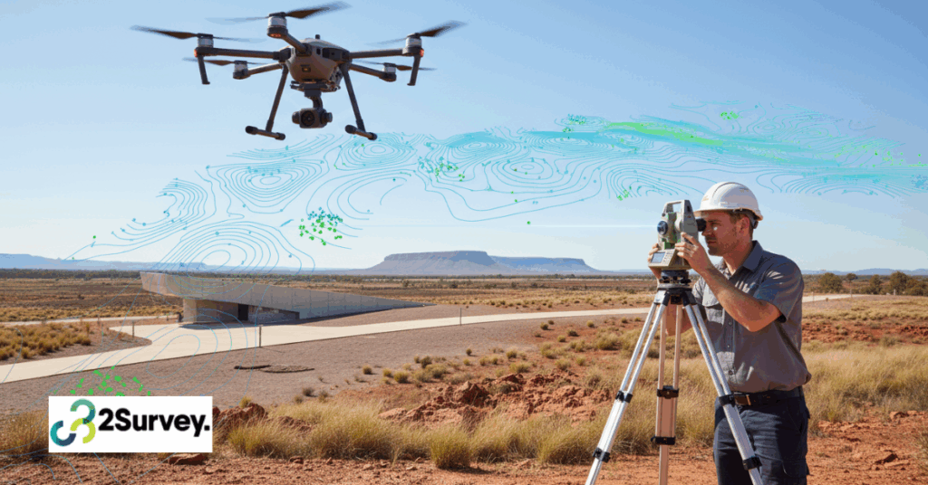
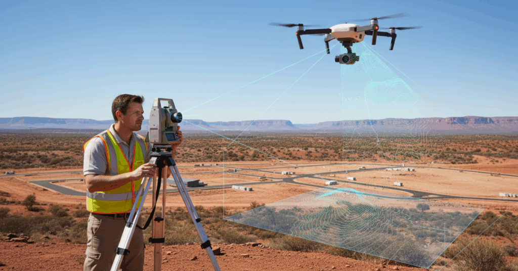
Drones (Unmanned Aerial Vehicles or UAVs) have high-resolution cameras and GPS systems among other sensors, making them capable of flying in large zones and recording data at altitudes. In surveying, drones find applications to take an aerial image and produce a detailed map, digital model, and 3D image. They may be flown automatically following set flight paths or manually operated based on the demands of the project. Today, surveyors Melbourne construction and infrastructure teams rely on are increasingly using drone technology to improve accuracy and efficiency on complex sites.
Drones are also very versatile and may be employed in a topographical survey, engineering surveying, construction monitoring, land survey, and so on. The current UAVs can operate in high altitudes, gather information in remote locations, and give very precise outcomes due to the continuous development of drone technology.
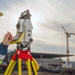
Laser Scanning 3D Mapping and Accuracy in Measurement.
Light Detection and Ranging, or laser scanning, is a technology that involves the use of laser rays to measure the distance to a surface or a body. These lasers scan the environment at very high rates, in a million data points in the form of a point cloud. The point cloud data is subsequently converted into 3D models of the surveyed area that are extremely detailed.
Laser scanning can be more accurate in measurements, and it can also be utilized to provide high-quality 3D maps, topographic models, and building plans, together with a drone. This is a priceless technology to survey complicated structures, landscapes, or regions that need high precision.
Major Benefits of the Drone and Laser Scanning Surveys
1. Additional Accuracy and Precision
The accuracy of both the drones and the laser scanners is also high and cannot be easily obtained when using the traditional methods of surveying. GPS and high-resolution cameras attached to drones are able to take the exact coordinates and descriptions. Laser scanners, at the same time, operate on the basis of measuring precise distances as detected with the help of light pulses, creating point clouds that are extremely precise, within the distance of millimeters.
The accuracy of drone and laser scanning surveys in NT has seen the technology being used in activities where a high level of topographical information is needed such as in building construction, land development, and infrastructure projects. Be it mapping the exterior of a building or the profundity of a river, these technologies guarantee you the highest level of precision regarding the information that you will get.
2. Time Efficiency and Speed
The time saved during the drone and laser scanning surveys is one of the largest benefits of this method of conducting the survey as opposed to the traditional one. Traditional surveying frequently involves the use of teams that have to measure distances by hand, navigate rugged terrain, and it may take hours or days to gather the information. Conversely, drones are able to cover larger distances within a fraction of the time, as they are able to collect the information fast and effectively.
Laser scanners are also faster than the traditional methods of data gathering since a substantial amount of information can be gathered within a few minutes. Together, drones and laser scanners have the potential to do a survey in hours, not days, which makes drones and laser scanners highly beneficial to shortening project timelines.
3. Reduced Costs
As the speed and precision are enhanced, drone and laser scanning surveys in NT can save a substantial amount of costs that are incurred by conventional surveying. The labor expenses decrease due to the requirement to have fewer staff and fewer sites, whereas the fast turnaround period prevents a project schedule delay.
4. Provision of Areas of Difficult Reach
There are places or situations which could be difficult or unsafe to survey by traditional means, like steep g, round, tall buildings, or dangerous places. Over places that are difficult or otherwise impossible to access, drones can fly over and capture data.
The areas that are difficult to measure manually can also have accurate data when laser scanning is applied. Laser scanners can map out the underside of a bridge or other delicate architectural features without having to expose employees to potential danger, whether it is through scanning the structure itself or scanning the furnishings.
5. In-depth Data Collection and Visualization
The degree of detail and visualization of drones and laser scanners is better than the conventional way of surveying the area. Data recorded by these technologies may be automated into 3D and point clouds and Ortho m, mosaics of high quality. Such visualizations give a better sense of the area under the survey, hence making it easier to analyze, plan, as well as make decisions. Construction progress monitoring, changes with time, and issues before they occur can also be performed with the help of 3D models and point clouds.
Conclusion
Drone and laser scanning surveys in NT are a major advance in the way of gathering, examining, and visualizing information. Their usefulness increases as their use improves accuracy, speed, cost-effectiveness, and access to hard-to-reach areas, thus making them invaluable tools in various industries such as construction or environmental monitoring, with professionals including surveyors Melbourne increasingly adopting these advanced technologies.
In the case of the company, focused on remaining at the forefront of the curve and focusing on the latest and high-tech solutions, drone and laser scanning surveys by 2Survey provide a fresh and efficient method of gathering information, streamlining operations, and making decisions. This is the future of surveying, and it is flying high with drones and laser scanning technology.
Frequently Asked Questions
Drone surveys use UAVs equipped with cameras and GPS to capture aerial images and data, helping create accurate maps, terrain models, and site progress updates.
Laser scanning (LiDAR) uses laser pulses to measure millions of points and generate precise 3D models of land, buildings, and structures with millimetre-level accuracy.
They capture faster, safer, and more detailed data, reducing site time, labour costs, and the chances of human error.
They’re widely used in land development, construction, mining, environmental monitoring, and remote-area mapping across the Northern Territory.
When combined, drones and LiDAR deliver high-precision data with accuracy often within a few millimetres, suitable for engineering-grade modelling.